Maybe you’ve heard the joke: Canada now has two seasons—polar vortex and forest fire.
While there’s nothing immediate we can do about the icy winters, the geospatial industry is at the innovative forefront of forest-fire prevention and detection. From human safety to the preservation of forest inventories and animal populations, geospatial technologies are making us safer and better able to react to fire-related emergencies, while saving money and resources.
Here’s a look at a few of them, in (literally) descending order, from outer space satellites to hand-held scanners.
Tracking lightning from high earth orbit. 35,786km above earth, aboard the GOES-17 weather satellite, the Geostationary Lightning Mapper (GLM) is taking 500 near-infrared pictures every second, monitoring and measuring the type of lightning often responsible for igniting wild fires down here in the Western Hemisphere.
Because it can detect cloud-to-cloud strikes (as well as in-cloud and cloud-to-ground), GLM gives weather forecasters and government agencies 5-10 minutes advance warning before ground strikes begin; this capability will only increase in importance as our warming climate brings lightning storms of greater number and intensity. Lightning can travel hundreds of kilometers before it hits the ground, so among GLM’s most crucial capabilities in terms of fire detection and prevention is the calculating of such trajectories. To see the latest Western Canada satellite imagery from GOES-17, visit Environment Canada here.
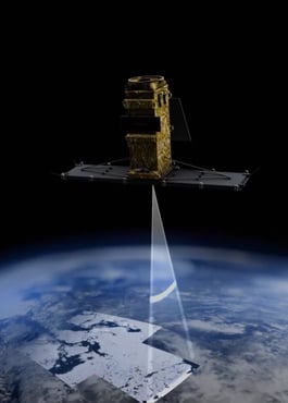
Recording electromagnetic radiation in the exosphere. At 829 km above Earth, the VIIRS (Visible Infrared Imaging Radiometer Suite) collects visible and infrared radiometric measurements of Earth—including the signature of anything hotter than approximately 200 degrees Celsius (flame ranges from 800 to 1200°C). VIIRS is thus able to detect much smaller fires than previous satellites were able to, and can produce images in near real time—around 3 hours, day or night. You can see VIIRS images of the 2019 High Level, Alberta, fire here.
Monitoring moisture from the thermosphere. In Alberta, the fire season starts with what’s known as the “spring dip,” the time between snow melt and the appearance of new growth, when trees may experience very low foliar moisture content, leaving vast areas of our forests susceptible to fire; the phenomenon was responsible in part for the eruption of six out-of-control wildfires in the province in May 2019. From 685 km up in the thermosphere, NASA’s SMAP (Soil Moisture Active Passive) satellite is measuring microwave emissions that can be correlated to water content in the top 5 cm of soil, providing a kind of early warning system for where to focus detection and prevention resources.
SMAP imagery is updated every 2-3 days as the satellite travels from pole to pole. To help provide more granular readings, NASA helped fund the development of a small, cost-effective unmanned aircraft system (UAS), which takes low-altitude, high-resolution, localized images and readings. The combination of these two data sets increases the accuracy of predicting where wildfires are more likely to occur and even how long they may smolder if they do in fact happen.
|
|
Canada’s eye in the sky: RCM radar Launched in June 2019, Canada’s next-generation RADARSAT-Constellation Mission (RCM) satellites, like the RADARSAT-2 satellite they are replacing, will produce soil moisture maps at resolutions higher than those produced by SMAP. The RCM satellites are still in the initiation phase, but Agriculture and Agri-Food Canada (AAFC) has already developed the ability for users to create soil moisture maps within 10 minutes of receiving raw satellite radar images. The synthetic aperture radar (SAR) antenna on each of the three identical satellites can “see” through smoke, clouds and haze; the Canadian government expects to use about 250,000 RCM images annually to monitor key ecosystems, including forests and agricultural lands. The RCM satellites orbit at approximately 600 km above Earth. You can learn more about the RCM and other Canadian Space Agency satellites here. |
Spectrometry in the stratosphere. NASA’s Airborne Visible/Infrared Imaging Spectrometer – Next Generation (AVIRIS-NG) sits aboard aircraft that fly 4-20 km above ground level, and helps identify, measure, monitor and inventory vegetation and its condition. The ability to know precisely, for example, what components of a forest are alive or dead, which stands of trees are beetle-infested and thus quicker to ignite than other trees, or what the moisture level is in particular terrain—all of this information is key to knowing where and when to deploy fire-fighting resources. So is knowing what kind of trees you’re dealing with in a fire area: conifers and deciduous trees burn differently; their branching characteristics determine how they burn; and whether they tend to grow close to the ground increases the likelihood that burning ground cover will ignite them. By recording spectral reflectance of forest areas, AVIRIS can tell us all these things.
Preventative LiDAR on the ground. Trees aren’t the only things that burn in a forest fire; to accurately understand how and where a fire will burn, we have to know the characteristics of the biomass—the layers of pine needles, twigs, small shrubs, fallen trees, etc., that exist below the canopy. Terrestrial LiDAR (Light Detection and Ranging), in conjunction with satellite LiDAR and innovative 3D modeling, provides us with the most comprehensive and detailed mapping of above-ground biomass that we’ve ever had. Land managers, forestry officials and industry stakeholders can now arm themselves with detailed forest inventories that allow them to make the most effective decisions possible.
Speaking of which, forest fires are not just a threat to vegetation—the people who fight them are also in constant danger. Mobile or handheld LiDar, in combination with satellite imagery, can help teams plot the best escape routes should an emergency arise. Sometimes the shortest route is not the fastest; vegetation density, inclines, and other landscape features that affect how—and how fast—a fire spreads must all be taken into consideration when every second counts.
When you think of fighting forest fires, you probably conjure images of brave men and women on the ground with hoses and axes, planes dropping retardant from above. Before we ever get to that point, however, multiple layers of sophisticated geospatial information and mapping technology—ranging from outer space to in-the-hand—are helping us understand, predict and prevent those fires from starting in the first place.
.jpg)